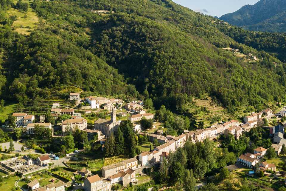
Pruneyrolles hamlet in Saint Pierre de Colombier
SAINT-PIERRE-DE-COLOMBIER
Pruneyrolles hamlet in Saint Pierre de Colombier
Medium
2h
4,5km
+213m
-214m
Loop
PR
Embed this item to access it offline
During this walk you will discover one of the Saint-Pierre-de-Colombier hamlets. Cross the chestnut groves, calades and typical terraces from Ardèche.
1 point of interest

Vue centrée sur le village et son église - S.Bugnon-ASV  Historical and religious heritage
Saint-Pierre-de-Colombier church
The church dates back to the 19th century. The front door is remarkable. It has been sculpt by an inhabitant of the village named M. Delubac. He also made a way of the cross as well as the Christ nearby the altar.
Description
- Departure point from the hikes info board on the market square. Take the center direction, pass the bridge that spans the Bourges and reach the RD 26.
- At the junction on RD26 turn left. Walk along the road on 200m passing by the Post office.
- At the cross, pass the road and climb up between the houses.
- On the church square observe the tympanum (arcade around the door) of the church, it has been cut by a passionate sculptor of the village (this is rare). Take the “Burzet 7.7km” direction walking along the church then cross the little bridge and climb up through the chestnut grove.
- At “Tarissou” cross, follow the “Burzet 7.2km” panel. Continue to the road. On the right you will discover some beautiful “faïsses” (terraces).
- At the “Champeaux” follow the “Saint-Pierre-de-Colombier 2.7km” panel. Follow the road on the left to reach “Arzalier” hamlet.
- At the entrance of the hamlet, take the path on the left that go through the houses, the meadow and the gardens. Enter the park by closing the fence. Continue the rocks path and reach the chestnutb grove to arrive at “Tarissou” cross.
- At “Tarissou” cross, follow the “Saint-Pierre-de-Colombier 0.9km” panel. At the church square follow the “hikes info board 0.4km”. This same track will leads you to the market square.
- Departure : Market square
- Arrival : Market square
- Towns crossed : SAINT-PIERRE-DE-COLOMBIER
Forecast
Altimetric profile
Recommandations
The loop is delineated by yellow and white painting.
Information desks
Tourism Office
2 place du Bosquet, Neyrac les Bains, 07380 Meyras
Access and parking
From Aubenas, take the N102 to Pont de Labeaume. At the village exit take right the D536 then Burzet direction. In Thueyts, take the N102 Aubenas direction before the Rolandy of Pont-de-Labeaume bridge turn left on the D536 the take Burzet direction.
Parking :
Market square.
Report a problem or an error
If you have found an error on this page or if you have noticed any problems during your hike, please report them to us here: