The Devil’s Bridge – Fargebelle
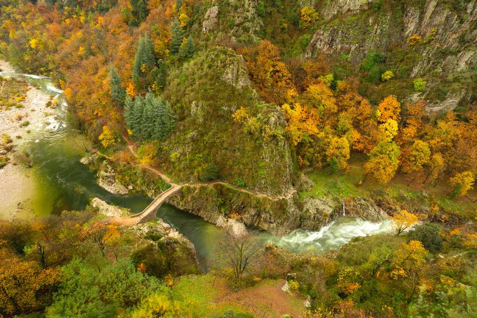
This director's cut of the Pont du Diable walk will take you to the other bank of the Ardèche River and will offer some beautiful sights on the Giant's Causeway (Chaussée des Géants) and its 80 m in height, and on the whole high valley of the Ardèche. It will also allow you to understand better the link between the volcano, well visible from the belvedere at the end of the Via Ferrata, and its basalt flow. Less "urban" than its little sister, l'Echelle du Roi (the king's ladder) the Echelle de la Reine walk will soon take you off the beaten track, up to the Fargebelle hamlet, typical of the Cévennes' closed hamlets of the 14th century. It will then take you to a gorgeous chestnut grove before leading you again across the Ardèche River on the Haute Vernède bridge, far less famous than the pont du Diable (Devil's Bridge) but just as beautiful. Nonetheless, if the queen's ladder is less impressive thant the king's, you will still have to summon up your courage to get back to the top of the basalt flow.
Description
- From Thueyts square, go down the N102 (white and yellow signs) in Aubenas/Neyrac direction.
- Just before the bridge, take on the left the via ferrata/pont du diable direction. To enjoy the view, you can cross the bridge to admire the devil’s bridge site from the lookout point of « la gueule de l’enfer ». Go under the bridge and go down the calade which pass under basalt columns.
- At the intersection, take right toward « Echelle du roi, Pont du diable ».
- At the next intersection, take left toward « Fargebelle 1.8km, Jaujac 9.1km ».
- Arrived on the road take right toward « le pont du diable ». At the « Plage publique » pannel, take right on the road. Go higher than the welcoming buldings of the Via Ferrata and the site and head for the scales which are in front of the devil’s bridge.
- Cross the bridge and take left on « Fargebelle-Mercier ». At the junction, take right toward the information board. The path weave going up to a belvedere which offer a magnificient view on the « Chaussée des géants » and Ardèche valley. The belvedere is on the arrival of the via ferrata too.
- Continue the rise in « Fargebelle » direction. The path cross a chestnut grove. Cross the bridge on the stream of Fargebelle and continue to climb.
- Careful, 50m further, the path slant on the left then on the right rising in a steepy way in the chestnut grove. Arrived under the big granite blocks, take right on the patio in « Fargebelle » direction.
- After around ten metres, you will arrive at the abandoned hamlet of Fargebelle.
- Take the path which get down on your right in « Thueyts, 3.2km » direction.
- At the intersection, careful, take the path which goes up on the left and follow with alertness the signs (don’t take the path) to go straight. The way exit the chestnut grove for a while to offer once again a very beautiful view on the upper Ardèche valley. Take the way down on the side of mountain then cross ford the Peyseline stream (careful with the rain).
- At the junction, in the chestnut grove, tale right toward « La Vernède, échelle de la reine ». The path is higher than the ruin barn and cross a nice chestnut grove that is in renovation. The way goes down snaking to the Vernede barn that you have to pass.
- Continue the way to the queen’s scale and its 215 steps.
- At the top, after around 10metres, take right (chemin des plots) then left between the walls. Arrived to the paved route, follow it to the national.
- At the crossroads of Travatel, take the street that goes in front toward right « Rue des Girauds » then take the second street on the right to return to the starting point, the square.
- Departure : From the pannel of hike on the square, go down with the N102 in Aubenas direction.
- Arrival : From the pannel of hike on the square, go down with the N102 in Aubenas direction.
- Towns crossed : THUEYTS
Forecast
Altimetric profile
Recommandations
The loop is delinead by yellow and white painting.
It is allow to swim at the Devil's Bridge.
Be careful as the queen ladder is impassable in cas of rain and don't enter Fargebelle hamlet.
Information desks
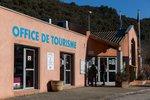
Tourism Office
2 place du Bosquet, Neyrac les Bains, 07380 Meyras
Access and parking
From Aubenas, take the direction of Le-Puy-en-Velay and continue on the road N102 up to the village of Thueyts.
Parking :
Report a problem or an error
If you have found an error on this page or if you have noticed any problems during your hike, please report them to us here: