Thines interpretive trail and its rock
MALARCE-SUR-LA-THINES
Thines interpretive trail and its rock
Easy
2h
2km
+62m
-63m
Round trip
Embed this item to access it offline
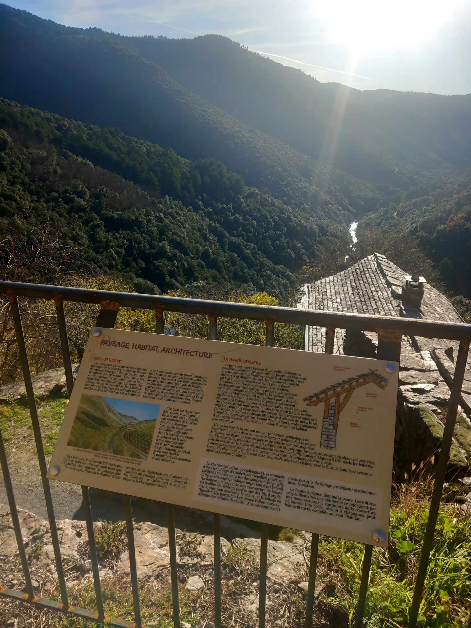
The theme of materials is the common thread running through the new interpretation trail, which comprises 10 panels on different themes: geology, history, archaeology, ethnology, architecture and landscape. You can wander around the hamlet as you please, accessing information from time to time or following the itinerary suggested here.
Intensive work in the archives has enabled us to gather the raw material for this route and compile a rich iconography that will delight heritage enthusiasts. Among the treasures on display are a photo of Thines by the photographer Doisneau and illustrations of the 19th-century classification of the church as a Historic Monument...
The highlights of Thines include, of course, the monumental staircase and the church of Thines, a Monument Historique, as well as unique views over the Cévennes valleys.
To complete the trail, a Thines discovery booklet is on sale at the Maison du Gerboul or at the Cévennes d'Ardèche Tourist Office in Les Vans or Joyeuse. It includes the contents of the trail and previously unpublished archive documents. An English version is also available.
Description
1) From the Terondel car park, at the bottom of the village, head up towards the village along the road.
2) Take a path under the road on the right (the Poets' Trail) and follow it until you reach the esplanade at the foot of the village.
3) This is the starting point for the interpretation trail, with a map of the hamlet to help you find your way around.
4) After a few metres, climb the few metres towards the Maison du Gerboul, the Park's Welcome and Information Centre, which houses a shop and tea room.
Continue up the stairs to find yourself at the foot of the monumental staircase.
5) Climb it to visit the church and the unique statuary on its portal.
6) On leaving the church, turn left into the cemetery. At the end of the cemetery is a notice board presenting the architectural features of the church.
7) Exit the cemetery and after a few steps, turn left to overlook the church and discover ‘images from the Middle Ages’.
8) Retrace your steps and head for the northern exit of the village, following the path up to the Monument de la Résistance.
9) From the Monument de la Résistance, continue to the car park at the end of the village to discover the viewpoint over the Thines valley and its geological interpretation.
10) At the end of the route, retrace your steps, this time taking the main road. There will be 2 heritage stops on the way down.
11) When you arrive in front of the Maison du Gerboul, stop for a moment.
- Departure : Térondel parking Thines
- Arrival : Térondel parking Thines
- Towns crossed : MALARCE-SUR-LA-THINES
Forecast
Altimetric profile
Sensitive areas
Along your trek, you will go through sensitive areas related to the presence of a specific species or environment. In these areas, an appropriate behaviour allows to contribute to their preservation. For detailed information, specific forms are accessible for each area.
Natura 2000 et ENS Plateau de Montselgues et de la vallée de la Thine
- Impacted practices:
- All practices
- Contact:
Recommandations
This is not a particularly difficult route, with no major changes in altitude, and it is often sunny. However, bring water and good shoes, especially if you decide to take the Poets' Trail.
Access and parking
From Lablachère, take the D4 towards Saint-Laurent-les-Bains and follow the road along the Corniche des Cévennes to the junction with the Route de Thines, which descends. From Les Vans, head towards Villefort, then Gravières and the D113, then up the Thines to the car park.
You must park in the Térondel car park at the bottom of the village. Access to the village is forbidden to motor vehicles.
From the car park, the village is 600m along a shaded path. For those who prefer an easier route, it is possible to reach the village on foot via the road, where traffic is very light.
Translated with DeepL.com (free version)
Parking :
Térondel parking Thines
Report a problem or an error
If you have found an error on this page or if you have noticed any problems during your hike, please report them to us here: