Route No. 12 : Le chemin des Cortasses
MONTRÉAL
Route No. 12 : Le chemin des Cortasses
Easy
2h30
9,3km
+252m
-253m
Loop
PR
Embed this item to access it offline
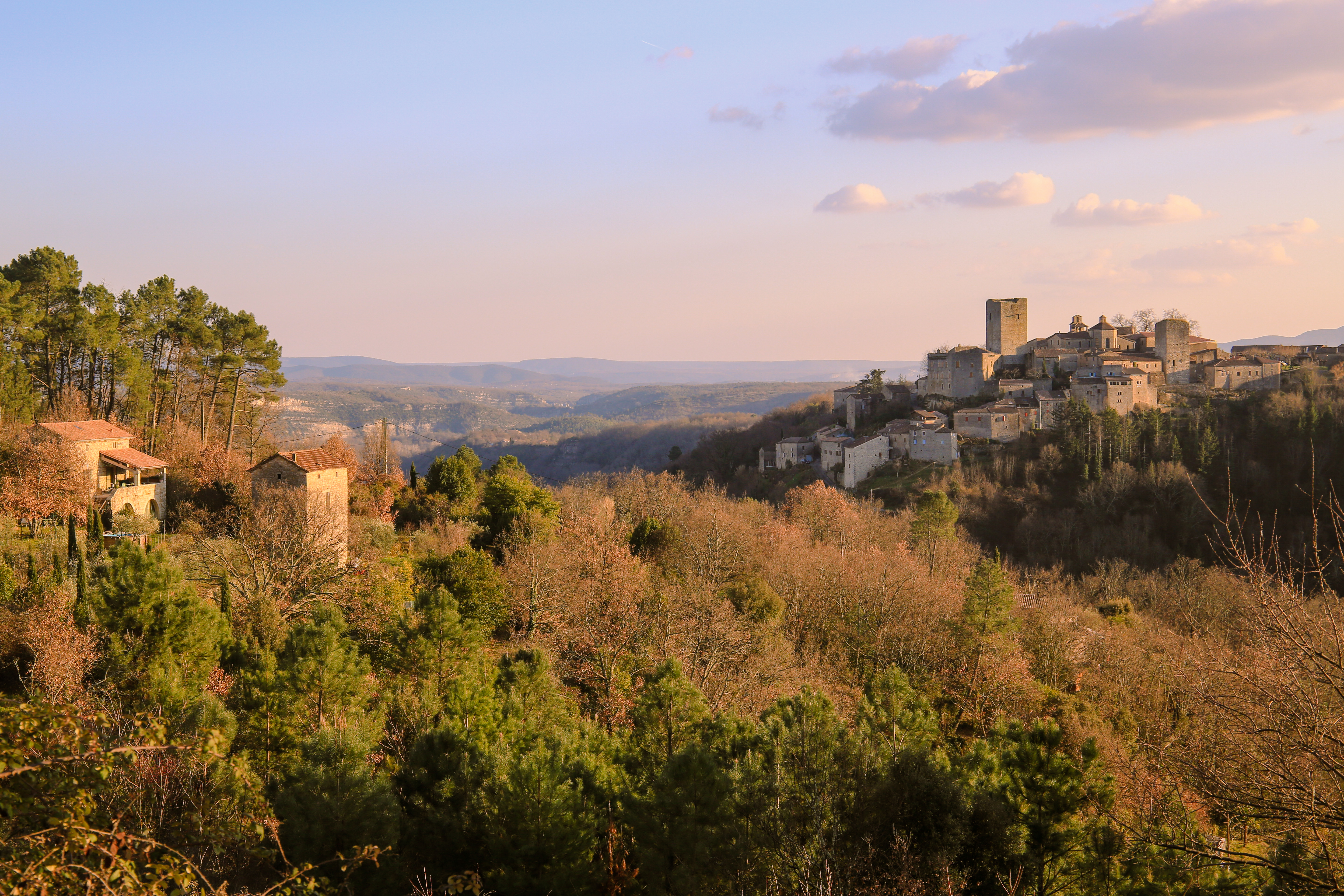
Immerse yourself in the heart of Laurac’s history and natural beauty during a hike along the Toufache stream. Follow the ancient mule paths, witnesses to the region’s vibrant past, and admire the remarkable dry stone walls, called "faïsses," built by skilled peasant builders. From there, enjoy captivating views over the Ligne river and the charming surrounding villages, inviting you to lose yourself in the timeless magic of this preserved landscape.
Description
Start from the village square: Take the direction of [Mas Gauthier 1 km, Laurac 3.7 km]. Cross the village through its alleys, then follow the drover's road. Cross the Charliac point, leave the road to take the path on the right. Continue along this pine-shaded cobbled path.
Mas Gauthier: [Laurac 2.7 km] On the right, follow the road for about 200m, then turn left. This very pleasant cobbled path then crosses the Farnayres stream. Continue until the junction.
Le Monteil: [Laurac 1.8 km] Continue and after 250 m, turn right then descend through the terraces to the "Chapeau du Gendarme." Follow the banks of the Toufache. At the crossroads, continue along the Toufache.
La Calade: [hiking info 0.8 km] At the crossroads, continue along the Toufache. Take advantage of your passage in Laurac to visit the village.
Le Lavoir: [Les Piles 0.2 km]
Les Piles: [Chadeyron 1.8 km, Uzer 6.5 km] Take the path that goes up on the left through the terraces. Follow the stream, mostly dry, on your left and after 20 m, take the trail going up on the right. This very pleasant path, called "la côte de la guerre," reaches the road. Follow it 200 m on the left, then take the path on the right crossing vineyards. After 400 m, turn left, the trail descends then climbs to join a road. Cross the bridge on the right.
Chadeyron: [Montréal 3.4 km] At the crossroads, go left. Cross the hamlet by the paved path then continue on the trail along the ledge. You overlook the Ligne and have a very nice view of the villages Largentière, Montréal, Chassiers. Reach the road. Turn left and after 250 m, take the path descending between two small walls, in the middle of terraces. Cross the stream then reach the road. Follow it for 100 m on the right then take the paved path on the left. Continue on the cobbled trail.
Mas Gauthier: [Montréal 1 km] Turn right and take back the same path as at the beginning of the walk to return to the village.
- Departure : Place du village, Montréal
- Arrival : Place du village, Montréal
- Towns crossed : MONTRÉAL and LAURAC-EN-VIVARAIS
Forecast
Altimetric profile
Information desks

Office de tourisme du Val de Ligne
3 rue du Maréchal Suchet,, 07110 Largentière
Transport
Ligne E13 et X74
Access and parking
Parking :
Place du village, Montréal
More information
Report a problem or an error
If you have found an error on this page or if you have noticed any problems during your hike, please report them to us here: