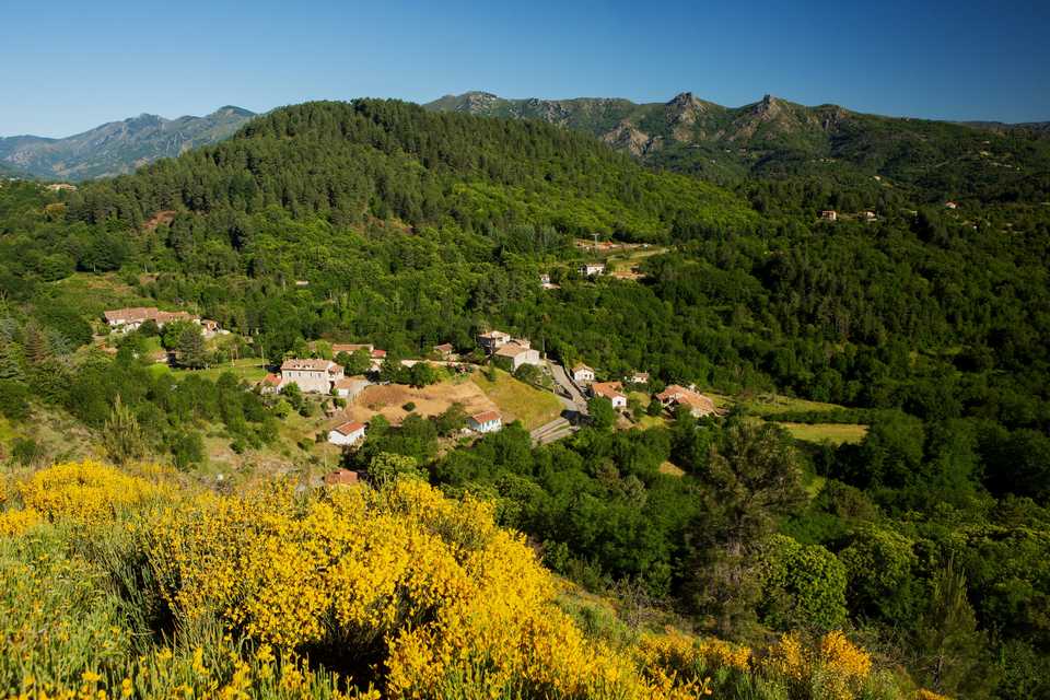
Around the volcano, St Cirgues de Prades
SAINT-CIRGUES-DE-PRADES
Around the volcano, St Cirgues de Prades
Medium
2h
5,2km
+139m
-140m
Loop
PR
Embed this item to access it offline
This walk has lots of surprises for you : The hills of the gardens, the spot of the hamlets
for their amount of sunshine, the the flow of numerous sources, the remains of Laulagnet castle, the
children screams from the forest and the gooses one.
for their amount of sunshine, the the flow of numerous sources, the remains of Laulagnet castle, the
children screams from the forest and the gooses one.
2 points of interest
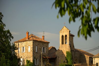
Zoom sur l'Eglise - S.Bugnon-ASV  Historical and religious heritage
Saint-Cirice church
This little piece of jewellery is situated in the Salyndre valley and date back to the 12th century. An important work of renovation inside has been made since 2007.
This monument welcomes since 10 centuries joyful and difficult moments of the community life. The inhabitants are attached to this church.
That is why the cultural aspect is important and the town is making this place a space of meetings (expositions, concerts...).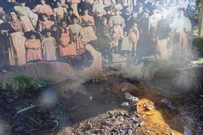
Source du Peschier - M.Barkats-ASV  Geology
Peschier source
At the bottom of the volcano the mineral water source so called of the Peschier which was made great use back in time. You still can savor on site its clear water, sparkling and ferruginous.
Description
Departure from the town hall square.
- Take the road to the junction.
- Cross the footbridge and take the pathway to « Laffont » post.
- Follow « Les Hugoux 1km » and « Jaujac 2.9km » directions to the junction with the road.
- You are at Peyrouse, cross the road and take the track that goes up. You can observe St Cirgues-de-Prades village on the back.
- Arrived at Mortier hamlet take the right. You will find a wash house on your left. Continue the pathway, go down by the calade to Hugoux hamlet.
- Take the « Jaujac 1.9 km » direction going down the road.
- Turn left and go down the trail.
- At the junction, take right walking along the greenhouse on your left. You can see the Peschier source on your left.
- Take the road in front of you to the junction of the D323.
- At the junction, turn right and 200m after going further than the chapel on your right, go down the track in Laulagnet direction.
- You are at Laulagnet hamlet, go down the road and take the pathway in front of it.
- At the junction with D323 road, take left following the road to your starting point.
- Departure : Town hall square
- Arrival : Town hall square
- Towns crossed : SAINT-CIRGUES-DE-PRADES and JAUJAC
Forecast
Altimetric profile
Recommandations
The loop is delineated by yellow and white painting.
Information desks
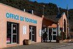
Tourism Office
2 place du Bosquet, Neyrac les Bains, 07380 Meyras
Access and parking
From Aubenas, take the N102 to Lalevade d’Ardèche then take the D19 on your left in
Jaujac direction. 1km before Jaujac take right the D323 to reach St-Cirgues-de-Prades village.
From the Est or North, take the D5 after Neyrac-les-Bains from the N102, at the end of the village
turn left and follow the D323 to St-Cirgues-de-Prades village.
Jaujac direction. 1km before Jaujac take right the D323 to reach St-Cirgues-de-Prades village.
From the Est or North, take the D5 after Neyrac-les-Bains from the N102, at the end of the village
turn left and follow the D323 to St-Cirgues-de-Prades village.
Parking :
Town hall square
Report a problem or an error
If you have found an error on this page or if you have noticed any problems during your hike, please report them to us here: