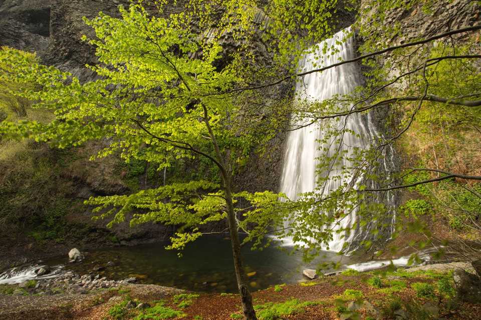
The Ray Pic waterfall in Pereyres
The GRP of the Haute Cévennes Ardèche will take you from the small town of Pereyres and its mountain houses to the Ray Pic waterfall. Besides its beauty, the Ray Pic waterfall is also known as an exceptional volcanic site, listed as Geosite by UNESCO. From the Ray-Pic there is a basalt flow that stretches on 20 kilometres, one of the longest in Europe. A little refitted path guide you to different wood terraces that overhang the waterfall. Breathtaking !
Description
Start at the ‘INFO RANDO’ sign in the car park below the village, on the right just after the bridge, in the Chambon district.
Cross the main road carefully and walk up La Calade to the village centre.
- At the village square.
 Follow the « Lachamp-Raphael 8,8 km » pannel. Climb the calade. You have a magnificient panorama on the Bourges valley and a beautiful view on Pereyres village.
 - Reach RD 215, take left to the Chabron hamlet.
- Go higher than the hamlet and follow the « RayPic 4km » direction. Continue on RD 215 to the Ray Pic bridge.
- Cross the bridge and take the snaking path on the left in the wood to the Ray Pic car park.
- Go down (15mn) on the track through the beech trees and the blueberry moors to the Ray-Pic waterfall. Returning to Pereyres is by the same way.
- Departure : The ‘Info Rando’ car park, just before you reach the village
- Arrival : The ‘Info Rando’ car park, just before you reach the village
- Towns crossed : PEREYRES
Forecast
Altimetric profile
Sensitive areas
Natura 2000 Secteurs des sucs Gerbier et Mézenc
Merci de bien vouloir rester sur les sentiers aménager afin de ne pas déranger la faune ni piétiner la flore.
- Impacted practices:
- All practices
- Contact:
Recommandations
The loop is delineated by yellow and white peinting.
Careful, swimming is prohibited at the bottom of the waterfall.
Information desks
Tourism Office
2 place du Bosquet, Neyrac les Bains, 07380 Meyras
Access and parking
From Aubenas, take the N102 to Pont de Labeaume. At the exit of the village take the D536 on the right, direction Montpezat-sous-Bauzon then take the D215 in Saint Pierre de Colombier direction. From Thueyts, take the N102 in Aubenas direction. Before entering Pont de Labeaume, take Montpezat-sous-Bauzon direction then the D 215 in Saint Pierre de Colombier direction.
Report a problem or an error
If you have found an error on this page or if you have noticed any problems during your hike, please report them to us here: