Geological path, between sea and mountain
SAINT-ÉTIENNE-DE-BOULOGNE
Geological path, between sea and mountain
Medium
4h
11,5km
+432m
-430m
Loop
Embed this item to access it offline
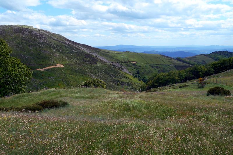
At the foot of the renowned Roche de Gourdon (Gourdon Rock), veritable sentry above the Escrinet that separates Southern Ardèche from the beginning of the Boutières, this walk is designed for nature lovers and all those of a curious turn of mind. Few walks enable the hiker to go, within a few kilometers, from a mediterranean atmosphere to a mountainous one, through chesnut groves and pastures. The path has just been improved by Gourdon and Saint-Etienne-de-Boulogne municipalities, with help from the Clapas association, to tell the history of these landscapes formation. 500 million years, no less, can be read there : the whole geological history of the Ardèche is here highlighted, from the palaeozoic to the quaternary era, where tectonics and erosion are intimatly linked.
Description
- From the church square in Saint-Etienne-de-Boulogne, take the narrow road uphill towards Auzon. Follow it up to the hamlet.
- You are now at Auzon. Above you, the Auzon pass is clearly visible. Go straight ahead and then turn right towards it.
- The narrow road becomes a track after the last houses and goes up quite steeply up to the pass.
- Once at the pass, go straight ahead towards Sarrasset. There, you swap valleys and landscapes: you see only extensive livestock farming and pastures. 800 meters away, the track gets wider. In front of you, 50 m further on, on each side of the track, a huge scree falls from the Truche summit : get nearer and look closely at the sandstone boulders. 500 m away, on the edge of the track, you will find a huge abandonned grindstone, poorly cut, bearing witness to a time when this sandstone was much in use. After 800 m, you will get close to the Auriol farm.
- Head past it and turn right on a narrow path in the direction of the Escrinet pass and the Gourdon farm, or continue on the track towards the Sarrasset pass by going North straight ahead (roughly 30 mn walk). You will see the Gourdon farm on your right.
- 700 m away, midway between the Gourdon farm and the Escrinet pass, leave the track and take the path on your right across the slope; lower, you will reach the old tramway line Le Pouzin-Privas-Aubenas.
- The track follows a gentle slope, suitable for this kind of machine, with wide bends.
- After the tramway line, at the end of a wide bend, a narrow path on your right is waiting for you. Leave it for a steep path in chesnut groves. After the chesnut trees, you will arrive near the hamlet of La Conchy.
- At the hamlet, take the shortcut below the road to get back to Saint-Etienne-de-Boulogne, your starting point.
- Departure : Saint-Etienne-de-Boulogne
- Towns crossed : SAINT-ÉTIENNE-DE-BOULOGNE and GOURDON
Forecast
Altimetric profile
Recommandations
En complément des tables d’interprétation présentes sur le sentier, les communes ont édité un petit livret d’accompagnement de 32 pages qui vient enrichir la lecture des paysages et expliquer l’ensemble des patrimoines rencontrés. Il est disponible en mairie, ou à l’office de tourisme.
Access and parking
From Privas, take the road D122 towards Mont Gerbier up to the 4 Vios pass.
Parking :
de l’église à Saint-Etienne-de-Boulogne.
Report a problem or an error
If you have found an error on this page or if you have noticed any problems during your hike, please report them to us here: