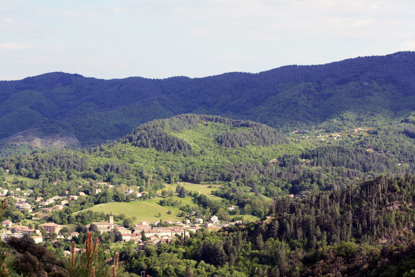
Jaujac crater and its basalt flow
The beautiful and typical village of Jaujac is surrounded by signs of an intense volcanic activity. Built for a large part on the flow of the last extinct volcano in the Ardèche, it is host to what many people see as the most beautiful basalt flow in Europe. Indeed, these columns overlooking the Lignon are a dramatic sight and well worth a stop. But Jaujac has other assets, among which its pleasant square, typical of Southern France, and its famed Chastelas neighbourhood. Lastly, since 2009, Jaujac has been home to the Maison du Parc des Monts d'Ardèche (Monts d'Ardèche Park's house), in the Rochemure castle, in front of the Chastelas. Don't miss it, especially in summer when exhibitions are organized there about various Monts d'Ardèche peculiarities. This walk will take you to very different landscapes, from the old streets of Jaujac to the edges of the Lignon Brook and its very special environment, before crossing the meadows and gardens of Rochemure and ending by the climb up the volcano among chestnut and pine trees. In short, there will be something for everyone.
4 points of interest
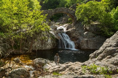
Vue sur le pont romain Jaujac - S.Bugnon-ASV  Built heritage
"Roman" bridge
The so called « roman » bridge permit to cross a little tributary of Lignon river : the Rieuclar. This bridge is actually Norman. Sweet waterfalls in autumn.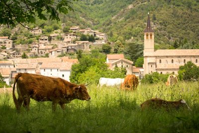
Jaujac-vue d l'église st Bonnet depuis la maison du Parc - S.Bugnon-ASV  Historical and religious heritage
Saint-Bonnet church
The actual Jaujac’s church has been built in 1848-1852. It presents vault in three-centered arch, paintings in the choir, three golden wood statues and a organ of 23 games installed in 1970 (concert).
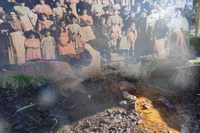
Source du Peschier - M.Barkats-ASV  Geology
Peschier source
At the bottom of the volcano the mineral water source so called of the Peschier which was made great use back in time. You still can savor on site its clear water, sparkling and ferruginous.
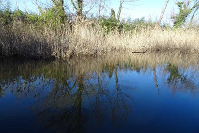
Au centre de la mare - M.Barka-ASV  Lake, river, waterfall
The dragonflies pond
We discover it going in the Jaujac’s volcano direction, along the « coulée vive » route. This enchanted place include two ponds of 800m². This marsh, naturally supplied by the volacanoe sources, is a natural paradise for the dragonflies.
Description
- 1st part: the old village and the basalt flow. Take the rue de la Pailhette (direction "le Chastelas, les coulées basaltiques, pont romain") and go down it up to Saint-Bonnet square. There, go downhill on your right towards le Chastelas. Cross the bridge, then turn right towards "les coulées, pont romain" above the river.
- At the crossways, go downhill on your right. You will find a Geo totem pole in the old mill.
- Once on the beach called "de la Turbine", go for a dip or continue on your left along the columns.
- Cross the Roman bridge and start climbing in front of you (follow the trail markings). Just before this climb, if the brook has dried off, go out of your way, 20 m on your left, to see our tiny Chaussée des Géants (Giant's Causeway) in the brook's bed: you will be walking on the flow's prisms.
- Once on the road, you will reach an interpretive board above it. Retrace your steps and start going downhill on the road. Continue up to the second bridge, then turn left for 100 m up to the belvedere.
- Enjoy the view and the interpretive boards, then retrace your steps for 50 m.
- Turn left on the cul-de-sac "chemin du Chastelas" that goes up to the village. Follow the tarmacked path leading to a belvedere.
- Take the stairs just behind you to reach a second belvedere at the base of the Chastelas' ruined keep. Then go back down to the first belvedere and turn right. After 50 m, take the stairs going down on the left (green markings, trail Chaussée des Géants) Follow the markings in the village up to the Chastelas bridge that you will cross again. Once on Saint-Bonnet square, carry on up to the fountain then take rue de la Molle.
- At the Office du Tourisme, turn left. You are back on the village square and the first part of the walk ends here.
- 2nd part : The climb up the volcano and the interpretive path called "la coulée vive". Take the rue du Trible in front of you. At the church, turn right to reach the Rochemure estate.
- Go up to the castle and skirt it on the right.
- Take the stairs on your left and go to the scale model and the estate map. You are now on "la coulée vive, curious path of the Monts d'Ardèche. It will take you to the Jaujac volcano through 12 interpretive facilities. Follow the red markings and the numbers on them.
- The path starts at the building in front of you, former farm shed that almost became a bottling factory at the beginning of the 20th century. Carry on through the garden then towards the pond and the small house on your right, la Clède.
- Head past it and take the path along the meadow. You will reach a cluster of trees. Still follow the red markings.
- At the belvedere, enjoy the view on the chipped crater's rim then retrace your steps for a few meters and take the straight path going down.
- At the crossways, turn left and carry on following the red markings. At the crossways, take the path on the right towards the chesnut trees. Continue along the water catchment perimeter up to the Peschier spring below the path.
- Go back on the path for a few meters and turn right to start the climb up the volcano. Go up the second path on your right.
- At the crossways, carry on straight ahead. At the next crossways, you will be able to choose either to continue straight ahead towards the crater, or to turn right to walk around it on its rim. This further loop will take up 30 minutes more, with a steep climb at the beginning, but offers beautiful sights on the Ardèche Cévennes.
- Once your reach the centre of the crater, retrace your steps and start going downhill, still following the red markings, or go around the crater. At the bottom of the forest, take the path straight ahead along the water catchment zone. Marking number 20 offers a stop at the Mare aux Libellules, or dragonflies pond (return trip). Then continue back to the Park's house. There, take the track back to the Champ de Mars square, your starting point.
- Departure : Jaujac, at the village square
- Towns crossed : JAUJAC
Forecast
Altimetric profile
Recommandations
L’itinéraire décrit un huit et propose de démarrer par la coulée pour ensuite grimper au volcan via le sentier d’interprétation de la coulée vive. Il est évidemment possible de faire l’inverse ou de ne réaliser qu’une seule partie de la boucle. Attention, la balade ne présente aucune difficulté particulière sauf l’ascension du volcan qui nécessite d’être bien chaussé.
Access and parking
From Aubenas, take the road N102 up to Lalevade d'Ardèche, then turn left on the road D19 up to Jaujac.
From the East or North, take the road D5 after Neyrac from the main road.
Parking :
Report a problem or an error
If you have found an error on this page or if you have noticed any problems during your hike, please report them to us here: