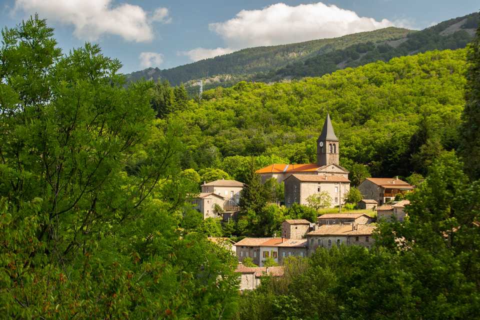
La Souche, the Mount Aigu circuit
LA SOUCHE
La Souche, the Mount Aigu circuit
Very hard
5h
9,2km
+729m
-732m
Loop
GRP
PR
Embed this item to access it offline
This hard - to very hard loop takes you from the lake of La Souche at 600m to the top of Mount Aigu at 1316m with a total ascent gain of 700m+. A more strenuous pathway is also accessible at several points on the hike.
Description
- Departure point from the hikes info board at Jean Moulin Square. Walk up from the square, ascend and turn right into the main street towards Pont Morand.
- Go past the bridge, continue on the same road for about 50m and
 follow the sign “Loubaresse 19.9km.” Go up the path of “Les Gardes” – once used by the foresters to access the Tanargue – cross the chestnut grove and then ford the Aiguebonne stream (be careful as it is impassable after heavy rains). The chestnuts are soon left behind as the trail winds among beeches, cross the field of granite stones (“clapas”) to reach the stoup (a bowl-shaped rock where rainwater collects).
 - You are now at Bournatas, to take a more difficult alternative trail, follow the sign “Sommet Mont Aigu,” otherwise continue the path to the post “Le Col des Langoustines”.
- From the “Col des Langoustines”, take left towards La Souche 5.5km.
- At the sign Col du Sucheyre”, take left to reach the top of Mount Aigu affording a 360-degree panoramic view of the Ardèche Mountains, The Cevennes, the southern part of the Central Massif, tMount Ventoux, Mount Lozère as well as the Alps on clear days. To continue the hike, retrace your path back to the crossing. Then take the trail on your left to the “Col la Grange”.
- At the post la Grange, for the more difficult alternative trail follow Rocles 18.7km, climb the path on the right, pass under the zip line cable – once used to move the hay to the village – and reach the edge of Rocles, otherwise continue the path in the direction of La Souche, crossing the stone site by the metal passageway.
- At the post “Les Plantades”, follow La Souche (1.8km) walk down “La Draille” through the chestnut trees.
- You have now arrived at the post “Les Quatre Chemins,” follow the signposted route to La Souche (1.3km).
- Cross the hamlet La Rabeyriol and take the road on the left for 100m.
- Take right and follow the track all the way back to departure point in La Souche (50m approx.)
- Departure : Parking area Jean Moulin
- Arrival : Parking area Jean Moulin
- Towns crossed : LA SOUCHE and LABOULE
Forecast
Altimetric profile
Sensitive areas
Along your trek, you will go through sensitive areas related to the presence of a specific species or environment. In these areas, an appropriate behaviour allows to contribute to their preservation. For detailed information, specific forms are accessible for each area.
Natura 2000 Massif du Tanargue, sources de l’Ardèche et de la Borne
- Impacted practices:
- All practices
- Contact:
Recommandations
The loop is delineated by yellow and white painting.
Information desks
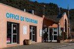
Tourism Office
2 place du Bosquet, Neyrac les Bains, 07380 Meyras
Access and parking
From Aubenas take the N102 to Lalevade d’Ardèche then take left on the D19 in the direction of Jaujac and continue for 4 km towards “La Croix de Bauzon”. If starting east or north of Aubenas, take the D5 after Neyrac-les-Bains on the N102. Follow it to Jaujac and from there take the “La Croix the Bauzon” direction.
Parking :
In the village square, at the Place Jean Moulin.
Report a problem or an error
If you have found an error on this page or if you have noticed any problems during your hike, please report them to us here: