Les gorges de La Beaume
SANILHAC
Les gorges de La Beaume
Hard
5h30
17,2km
+785m
-779m
Loop
GRP
Embed this item to access it offline
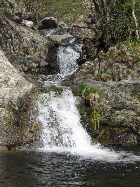
La Beaume rises in Loubaresse and makes its way through the hard granite of the Tanargue before crossing the soft limestone of the Gras plateau and flowing into the Ardèche River at Ruoms.
Description
P – Cross the Pont du Gua bridge and take the road left for 100m. The trail begins on the edge of the road to the right and follows the Tour du Tanargue ( ) GRP.
 Colobrouze - Follow La Roche 5,6 km. The trail climbs in steep zig zags to La Roche.
- La Roche - Follow Rocles 9,4 km. On the road, turn right, then a little further on, on a bend, continue on the road to the left towards Vaneyre. Continue on the trail to Peytot.
- Peytot - Follow Rocles 7,1 km. On the road, turn right; a little further on, continue on the path on the right. Cross the road and go down to La Parot.
- La Parot - Follow Rocles 5,4 km. Cross the bridge and on the road, turn right; after the houses, the path goes left to Entrée de Champussac.
- Entrée de Champussac - Follow Rocles 4,3 km. Go down to the road on your right. Cross the bridge and take the path on the left that goes up to Sur le Sauze.
- Sur le Sauze - Follow Beaumont 9,7 km. Continue along the path to Croix de la Marre.
- Croix de la Marre - Follow Beaumont 8,8 km. Continue along the road, and a little further along, take the path on your left. On the road, turn left towards the Tour de Brison to Loup du Perrier.
- Loup du Perrier - Follow Beaumont 7,5 km. Stay on the road and then take the first track on the right to Collet de la Berle.
- Collet de la Berle - Follow Beaumont 7 km. Continue along the Tour du Tanargue () GRP down towards St Pierre de Malet.
- St Pierre de Malet - Follow Beaumont 5,5 km. Go down to the road then cross the Pont du Gua bridge to reach your starting point.
- Departure : Le Pont du Gua, Beaumont
- Arrival : Le Pont du Gua, Beaumont
- Towns crossed : SANILHAC, ROCLES, and BEAUMONT
Forecast
Altimetric profile
Information desks
Office de tourisme des Cévennes d'Ardèche
Joyeuse/Les Vans
Transport
Let us limit travel by car, think of public transport and carpooling. All public transport on transports-region-auvergne-rhone-alpes
Access and parking
From Les Vans (30 km) join Joyeuse (13 km) and continue on the D203 towards Valgorge until the Pont du Gua.
Parking :
Le Pont du Gua, Beaumont
Report a problem or an error
If you have found an error on this page or if you have noticed any problems during your hike, please report them to us here: